Picture your morning coffee with the San Juan River as your soundtrack or a quiet afternoon by a glassy lake. If you are exploring Pagosa Springs for a waterfront home, you will find a mix of riverfront, creekside, lakefront, and pond properties, each with its own rules and value drivers. It can feel complex, especially if you are comparing access, flood zones, wells, and water rights. This guide breaks it down so you can search with confidence and make a smart offer when the right place appears. Let’s dive in.
What counts as waterfront in Pagosa Springs
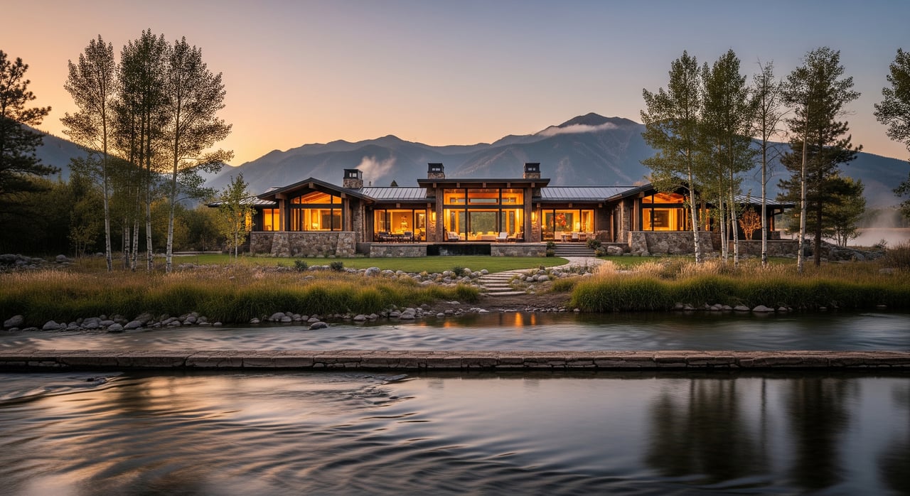
Riverfront on the San Juan River
The San Juan River is the primary waterway through Pagosa Springs. Homes along the river range from small in-town lots and condos to rural acreage with long stretches of private frontage. Usability depends on shoreline slope, vegetation, and whether you have deeded access to the bank.
Creekside and tributaries
Many Archuleta County parcels sit on smaller creeks and seasonal tributaries. These areas often have steeper banks and dense vegetation. They can offer privacy and a natural setting, with more limited boating and variable year-round flows.
Lakefront and reservoirs
Lake and reservoir parcels are less common than riverfront but appeal to buyers focused on boating and still-water fishing. Proximity to ramps and recreational infrastructure affects value. Check rules and public access details with Colorado Parks & Wildlife.
Ponds and private water
Some rural acreage includes a private pond. These are usually for aesthetics, light fishing, or small craft rather than wide-water recreation. Maintenance, liners, and water sources vary by parcel.
Subdivision access vs deeded frontage
Many newer communities offer shared easements or HOA-managed access points instead of exclusive, single-owner frontage. A water view does not always equal private access. Confirm whether you have deeded shoreline or shared access only.
Where you find these homes
Downtown and hot-springs corridor
In-town riverfront often means shorter lots, condos, or small single-family homes. You gain walkability to shops and amenities. Expect tighter parcels and closer neighbors versus rural stretches.
Ranch and ranchette country
Outlying areas can include long riverfront segments, larger acreage, and more privacy. These properties often sit off county roads and may have varied winter access and services.
Subdivisions near town edges
Planned communities around the town perimeter may include deeded easements and private access points. HOA rules and shared maintenance can influence costs and use.
Lake-adjacent parcels
Lake and reservoir proximity is typically a short drive from town. Boat ramps and recreation infrastructure shape pricing and lifestyle.
What drives value and price
- Direct water frontage vs view-only
- Usable shoreline and slope for easy access
- Floodplain location and FEMA designations
- Water rights and legal access
- Acreage, privacy, and road access in all seasons
- Proximity to Pagosa Springs amenities and services
Typical price context in Archuleta County
Waterfront homes generally command a premium over similar non-water properties. In the Pagosa Springs area, outcomes vary by type and setting. Entry-level riverfront cottages or condos often start in the mid-to-high six figures in many mountain resort towns, while typical single-family riverfront homes commonly range from the mid six figures to the low or mid seven figures. Large ranches with significant river frontage and acreage often move into the high seven figures or higher. Always compare current MLS data and recent sales before you make an offer.
Floodplain and insurance basics
How to read flood maps
Use the FEMA Flood Map Service Center to see if a property lies in a Special Flood Hazard Area. Lenders typically require flood insurance for homes in these zones when using a federally backed mortgage. Request an elevation certificate and review Archuleta County’s planning and GIS overlays for local context through Archuleta County’s official site.
Insurance costs and lenders
Standard homeowners insurance usually excludes flood damage. If a home is in a Special Flood Hazard Area, your lender will likely require coverage through the National Flood Insurance Program or a private policy. For basics and cost factors, review National Flood Insurance Program guidance.
Access, boundaries, and permitting
Deeded frontage vs easements
Deeded frontage means your parcel includes the bank to a surveyed boundary. Easements can provide shared or limited access without full ownership of the shore. Verify deeds, plats, and recorded easements with the Clerk & Recorder.
Public access and high-water mark in Colorado
Public-use rules depend on state law and whether the waterbody is considered navigable. Colorado’s access rules are nuanced. Confirm public access rights and whether any routes cross private land for your specific river segment.
Roads, winter access, and maintenance
Some rural waterfront parcels rely on shared private roads or county roads with variable winter maintenance. Road-maintenance agreements and HOA assessments affect both costs and accessibility.
Riparian setbacks and shoreline work
Setbacks, wetlands, and buffer protections can limit how close you can build. Docks, bank stabilization, and retaining walls may require county or state permits. Start with Archuleta County Planning and GIS, and confirm any additional oversight with state agencies before you plan improvements.
Water, wells, septic, and recreation
Colorado water rights 101
Colorado follows prior appropriation. Owning riverfront land does not automatically grant the right to divert water. Water rights are separate, transferrable property interests administered by the Colorado Division of Water Resources. Instream flow rights held by the state can also limit new diversions.
Domestic water and wells
Many rural properties rely on private wells. Verify well permits, drilling records, yield, and water quality through the Division of Water Resources. In-town homes may connect to municipal water. For remote areas, consider storage and backup planning.
Septic near water
Most rural waterfront homes use onsite sewage systems. Design, permitting, and setbacks from water and wells are overseen locally. Review records and standards with San Juan Basin Public Health, and plan inspections early.
Recreation and fisheries
Boat ramps, public access points, and seasonal flows determine how you use nearby water. Fishing regulations and stocking are managed by Colorado Parks & Wildlife. Rules can vary by waterbody and season.
Your Pagosa waterfront due diligence checklist
- Compare current MLS comps for waterfront vs non-water properties.
- Pull deed, plat, and all recorded easements. Confirm your boundary to the bank or high-water mark with a surveyor if needed.
- Check FEMA flood maps and request an elevation certificate for any structure near the water.
- Order a title search to surface easements, prescriptive rights, or claims that affect access.
- Confirm any appropriative water rights or shares if you plan irrigation or diversion. Consult a water attorney or engineer and the Colorado Division of Water Resources.
- Verify well permit, depth, yield, and water quality. Schedule a pump test.
- Review septic permits and compliance with setbacks through San Juan Basin Public Health.
- Clarify permits for docks, bank work, shoreline stabilization, or retaining walls with county and state agencies.
- Confirm road access, winter maintenance, and any private-road or HOA assessments.
- Assess wildfire exposure, defensible-space needs, and insurance implications.
- Identify wetlands, conservation easements, or endangered-species constraints.
- Map the nearest public access points, ramps, and any private mooring or dock rights.
Smart next steps
- Hire local pros. Engage a real estate advisor experienced with Pagosa waterfront, a title company, a water-rights attorney, a licensed surveyor, and well/septic inspectors.
- Time your visits. If possible, view the property in different seasons. Spring runoff can reveal flood and access conditions not obvious in late summer.
- Align your goals. Decide whether you value quiet frontage, walkability to town, boating access, or acreage privacy. Your priorities will steer the search and negotiation strategy.
If you are weighing options around Pagosa Springs, you deserve clear, practical guidance. For confident due diligence and negotiation-ready advice, connect with Jeremiah Aukerman - eXp Realty Luxury.
FAQs
What types of waterfront homes exist in Pagosa Springs?
- You will find riverfront on the San Juan, creekside parcels on tributaries, lakefront or reservoir-adjacent homes, rural acreage with private ponds, and subdivisions with shared access.
How does flood insurance work for Pagosa riverfront homes?
- Lenders usually require flood insurance if a home is in a FEMA Special Flood Hazard Area. Check the address on the FEMA map, get an elevation certificate, and price coverage through the NFIP or private carriers.
Do Colorado riverfront owners automatically have water rights?
- No. Colorado follows prior appropriation, so water rights are separate from land ownership. Verify any rights through the Colorado Division of Water Resources and consult a water attorney.
Can you build a dock or stabilize a shoreline in Archuleta County?
- Possibly, but permits are often needed. Confirm county rules, and check for state or federal oversight if wetlands or larger waterbodies are involved.
What should I check on wells and septic for a waterfront property?
- Confirm the well permit, depth, and yield; test water quality; and review septic permits and setbacks with the local health authority. Plan inspections early in your contingency period.
Where can buyers find boating or fishing access if they own private frontage?
- Access depends on flows, hazards, and local rules. Use public ramps and access points, and follow Colorado Parks & Wildlife regulations for fishing and boating.