Thinking about buying land near Pagosa Springs but not sure if you can build on it or even reach it year-round? You are not alone. Between zoning rules, easements, wells, and winter road realities, vacant land here rewards careful homework. This guide walks you through zoning and access essentials in Archuleta County and the Town of Pagosa Springs so you can move forward with clarity and confidence. Let’s dive in.
Know your jurisdiction first
Before you review any rules, confirm whether the parcel sits inside the Town of Pagosa Springs or in unincorporated Archuleta County. Each has its own zoning, permits, and utility rules. If you are near the town boundary, check both.
- Start with a call or visit to Archuleta County Planning and Zoning.
- If the property might be inside town limits, also contact the Town of Pagosa Springs.
- Ask for zoning confirmation and any conditional use or variance history. A zoning verification letter provides written clarity on what you can do.
Inside town vs. unincorporated county
Inside town limits you will generally see conventional zoning and access to municipal water and sewer. Outside town, most parcels rely on private roads and wells with onsite septic systems. Your path to building will look different depending on where the land sits, so verify jurisdiction early.
Understand zoning and permitted uses
Zoning determines what you can build, where you can place it, and what else you can do on the land. Expect categories like residential, rural or agricultural, forestry or recreational, and commercial or industrial.
- Confirm setbacks, height limits, and accessory buildings.
- Ask about minimum lot size rules and whether your parcel meets them.
- If you plan to operate a business from the property, verify it is allowed in that district.
Subdivisions, plats, and covenants
Many rural lots are part of recorded subdivisions with CC&Rs and plat notes. These can control building envelopes, road maintenance responsibilities, and design standards. Unsubdivided acreage can carry different rules for septic, wells, and future lot splits. Get the recorded plat, covenants, and any road agreements during due diligence.
Short-term rentals
Rules for short-term rentals differ between the county and the town and can change over time. Ask planning staff about current registration, licensing, occupancy taxes, and safety inspections. Do not assume STRs are allowed in your zoning district without written confirmation.
Confirm legal and physical access
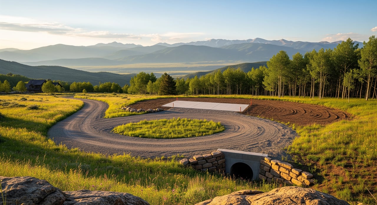
A great building site is not enough if you cannot legally reach it. In the Pagosa Springs area you will find a mix of public roads, private maintained roads, and unimproved tracks that may be seasonal.
What counts as legal access
Legal access usually comes from a public road or a recorded easement. Your deed, title commitment, and survey should show the road or right-of-way that benefits your parcel. Review easement documents for width, maintenance obligations, gate rules, and any limits on vehicle type or snowplows.
- Ask for a current title commitment and a survey showing all access easements.
- Confirm the road classification with the county: county-maintained, private maintained, or private unimproved.
- If the only access crosses federal land or private neighbors, verify a recorded right-of-way and usage permissions.
Driveway and road standards
When you connect to a county road, you may need a driveway or culvert permit and to comply with drainage standards. In winter, many private and mountain roads are not plowed by the county, so confirm who handles snow removal and who pays for it. If year-round access matters to you, drive the route in winter before you buy.
Water, septic, and utilities that affect buildability
You need a plan for water, wastewater, and power. Inside town limits, municipal service may be available. In rural settings, you will likely rely on a well and a septic system, with electricity extended from the nearest line.
Wells and water rights
Colorado regulates wells through the State Engineer. Domestic well rules vary by basin, and some areas have extra restrictions. For a vacant lot, verify whether a well can be permitted and whether the land carries any surface water or ditch rights.
- Request existing well logs and water-right certificates if present.
- Ask the Colorado Division of Water Resources about well permitting and local groundwater conditions.
- If surface water or ditch rights are claimed, ask for documentation and understand how they can be used and transferred.
Septic and onsite wastewater
Outside municipal sewer service, you will need an onsite wastewater treatment system. A site evaluation typically checks soils, depth to limiting layers, and setbacks from streams or wells. Parcels near the San Juan River or tributaries may need engineered systems or increased setbacks.
- Contact the permitting authority and review requirements at the Colorado Department of Public Health and Environment.
- Plan for time and possible engineering if soils are marginal or bedrock is shallow.
Electricity, gas, and internet
Many rural parcels are served by electric cooperatives. Extending power to a remote site can require a cost-sharing agreement. Natural gas is available in some corridors; elsewhere, propane is common. Internet options vary from fiber in certain subdivisions to fixed wireless, cellular, or satellite in more remote areas. Confirm provider availability and extension costs for the specific parcel.
Environmental and title checks that matter
Environmental conditions and title details can limit where and how you build. They can also affect insurance, financing, and long-term enjoyment of the property.
Floodplain and wetlands
Review FEMA flood maps to see if any part of the property sits in a 100-year floodplain, especially near the San Juan River or tributaries. Building in a flood zone can trigger elevation requirements and may require flood insurance. Wetlands and riparian buffers can further limit buildable areas.
- Start with the FEMA Flood Map Service Center.
Wildfire risk and mitigation
This region has wildfire exposure, particularly near forested lands. Some lenders and insurers evaluate wildfire risk and may require mitigation. Planning for defensible space around your future building site is a smart move.
- Review guidance from the Colorado State Forest Service.
Soils, slope, and geotechnical
Steep slopes, shallow bedrock, or unstable soils can increase foundation and grading costs and may trigger special county requirements. Mapping tools are a helpful first pass, but a site-specific geotechnical review is often required for construction.
- Check the USDA NRCS Web Soil Survey for preliminary soil and slope context.
Adjacency to public lands
Proximity to San Juan National Forest or BLM parcels can enhance views and recreation, but can also mean seasonal road closures and increased wildfire risk. If your access crosses federal land, confirm that vehicle travel is allowed and whether any permits or agreements are required.
Mineral rights and surface use
In Colorado, mineral rights can be severed from the surface estate. Your title commitment should disclose any reservations or leases that could create surface conflicts. Ask the seller for a mineral-rights affidavit and have your title company summarize all easements and restrictions that affect building locations and road use.
A practical due-diligence checklist
Use this list to structure your research and get written confirmations before you close:
- Get the recorded deed, plat, and all covenants or restrictions. Note any building envelopes, setbacks, or road maintenance terms.
- Order a current title commitment and a survey that shows boundaries, easements, and access. Consider an ALTA survey if you need precise utility and easement detail.
- Confirm zoning and permitted uses with the county or town. Request a zoning verification letter.
- Verify legal road access in recorded documents and confirm who maintains it. Ask the county to classify the road and share snow-plow practices.
- Check utility maps or contact providers to confirm proximity of electric, gas, and telecom. Request written extension estimates.
- Investigate water. Pull well logs if they exist and contact the State Engineer for well-permitting guidance. If surface water rights are claimed, obtain documentation.
- Evaluate septic feasibility. Order a site evaluation and consult the permitting authority about system types and setbacks.
- Review floodplain and wetlands. If near streams, consider a civil or site survey to define buildable areas.
- Assess wildfire exposure. Review state guidance and plan for defensible space.
- Review mineral rights, oil and gas leases, and all recorded easements. Ask for disclosures and consider an attorney review if anything is unclear.
- Test physical access in different seasons, especially winter.
- Build a realistic timeline. Permits and utility extensions can take weeks to months.
Timelines and budgeting basics
Vacant land often requires more time and upfront planning than a resale home. Well permits, septic design, surveys, and utility extensions each add time and cost. Steep terrain, shallow bedrock, or floodplain constraints can lead to engineered solutions that cost more but protect your long-term value.
Get written estimates from well drillers, septic designers, electricians, and road contractors early. This lets you compare parcels with real numbers and negotiate with confidence.
Ready to walk through a parcel with a practical, buildability-first lens? Reach out to Jeremiah Aukerman - eXp Realty Luxury for local guidance tailored to your goals.
FAQs
Can I drill a well on vacant land near Pagosa Springs?
- Possibly, but you must confirm local groundwater conditions and obtain a well permit from the Colorado Division of Water Resources; a local well driller can advise on feasibility and cost.
How do I confirm legal road access to a rural Archuleta County lot?
- Review the deed, survey, and title commitment for a public road or recorded easement, and confirm road classification and maintenance responsibilities with the county.
Are short-term rentals allowed on land I plan to build on?
- Town and county rules differ and can change, so ask the planning office in the correct jurisdiction for current STR allowances, licensing, and inspection requirements.
What permits might I need for a driveway connection?
- Archuleta County may require driveway and culvert permits for connections to county roads and may enforce drainage standards; verify requirements before you design access.
How do I check if a parcel is in a floodplain near the San Juan River?
- Start with FEMA flood maps and then verify on-site with a surveyor if your parcel is close to mapped flood zones or riparian areas.
What hidden costs should I budget for when buying rural land?
- Potential costs include driveway and culvert work, road maintenance, power line extensions, engineered septic systems, well drilling, surveys, and wildfire mitigation.